Below are some photos from the hike - you can click on a photo to see a larger version. Also, I've written up a trip report which I'm sure will be of interest to millions. (Anyone contemplating this hike might be interested in reading my trip report as the hike description in the book I have - a popular book of hikes in this region - had a few ambiguities.)
Trip Report
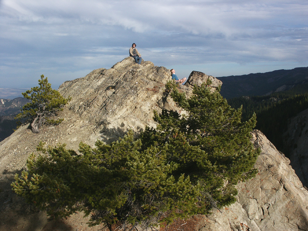
The Mount Lillian Loops are Hike #40 in 100 Hikes In Washington: Alpine Lakes. We did the short loop. The book claims 400 ft of elevation gain, but there is probably twice or more that, because you get 400 feet in short order right away, climbing up Mt. Lillian, then you go steeply uphill twice later in the hike. The path is well worn by horses and much of it consists of deep powdery dirt. There is also a lot of motorcycle traffic in the area, though not on most of the short loop, at least. What this hike has going for it are the excellent views from the top of Mt. Lillian and a ridge of very cool rock pinnacles just past the crest of the mountain.
We left late, appx. 12:30pm, because we're on late schedules, we hadn't chosen a hike beforehand, and because Tom had to run an errand in the morning. (Ideally, we would blame it all on Tom, but there you have it.) It took around 3 hours to get from Seattle to the trailhead; the last ten miles to the trailhead were slow going on pitted gravel roads (road #9716, then turning onto #9712). The weather was good; a little cool, but fine once we started walking.
We parked at the campground at Haney Meadow, walked up the road to Tronson Ridge Trail and started up that. This was our first bit of confusion: the trail was not labeled with the number that the book indicated, so we initially continued up the road, then pretty quickly decided that because of the direction of the road, the trail we had passed must have been the one we wanted, so we turned around.
Almost immediately we came across three dirt bikers checking out a new-looking pickup truck off-road and stuck in the mud. One of the bikers was a sheriff and we thought the truck other two, but it turned out that all three were just out riding together and came across the abandoned truck, and were attempting to call it in to the forest service on their radio. The sheriff had a map and was able to confirm that we were on the correct trail, so we continued just a bit further to where we turned onto another trail that headed up Mt. Lillian (apparently Mount Lillian Trail #1204, but it's unmarked).
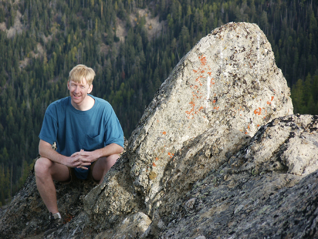
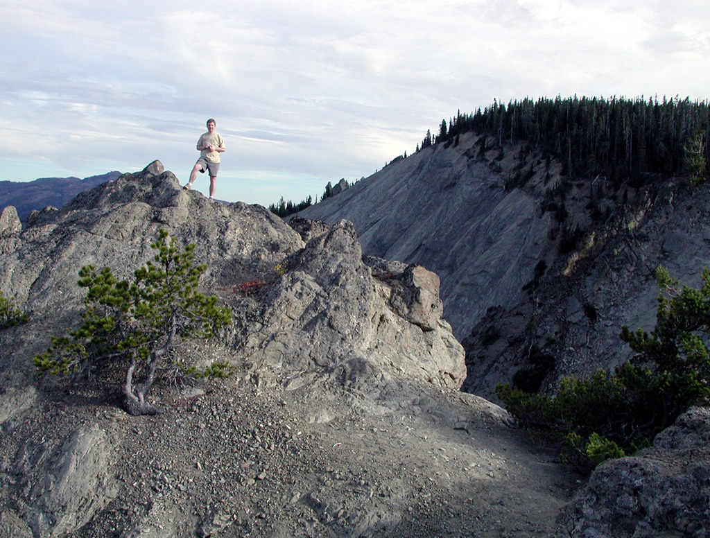
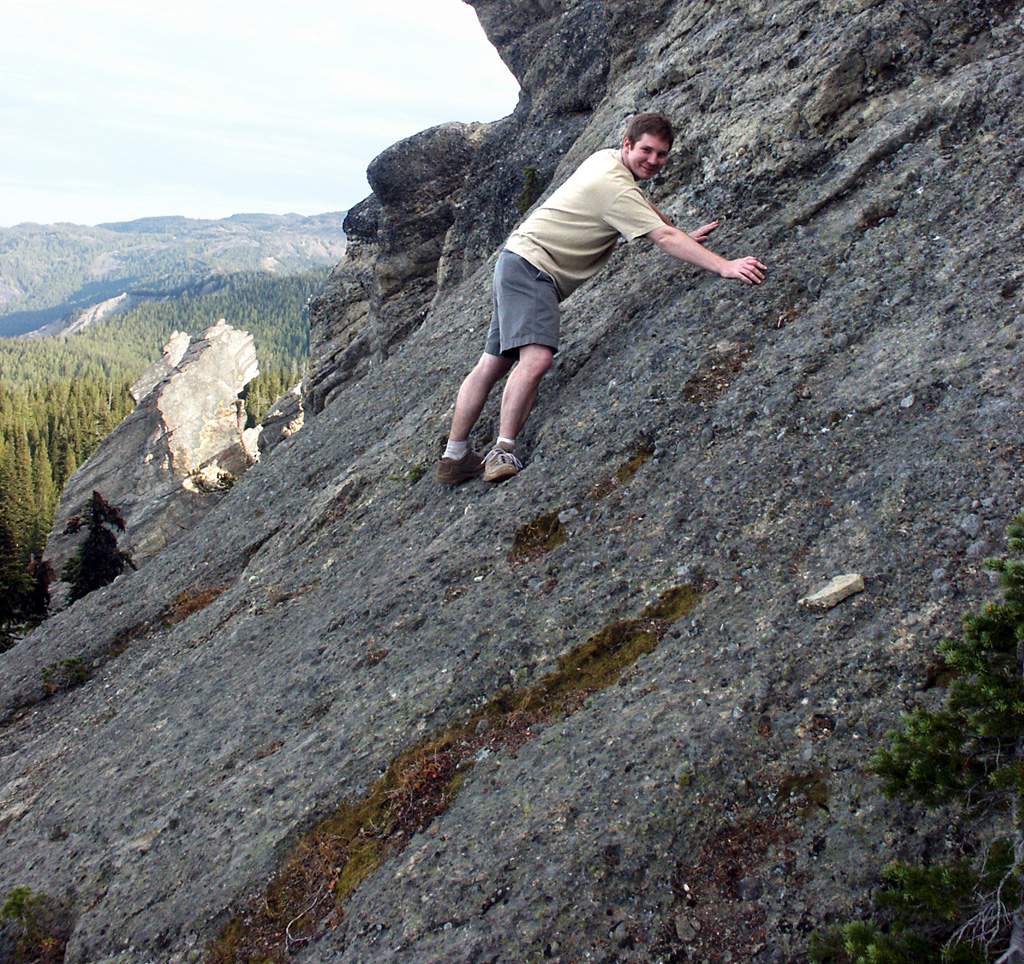
The trail up Mt. Lillian was very steep but it didn't take too long to get near the top, where an exposed shoulder (a little off the trail but pretty obvious) gave excellent views over Devil's Gulch (according to the book) and the mountains beyond. We made a long stop there for food and views and photos.
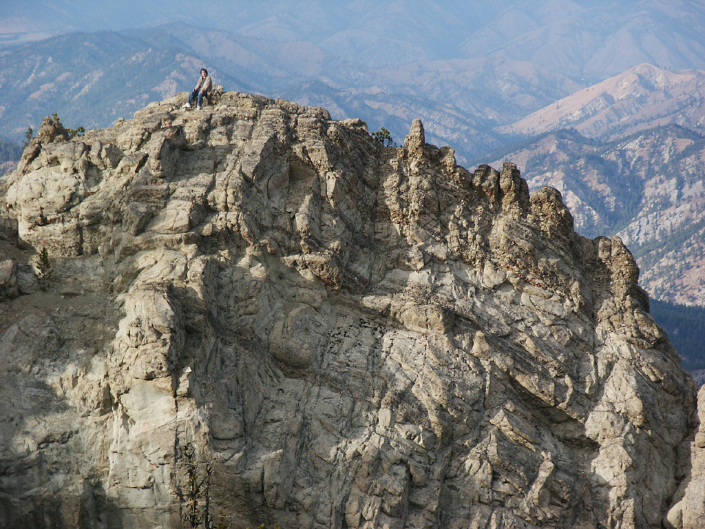
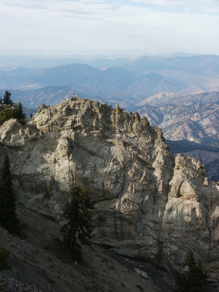
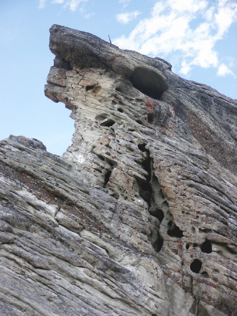
Over the top of Mt. Lillian we encountered a string of very cool rocky pinnacles, and again made a long stop to scramble around in the rocks (being careful as one side had a steep slide down for a long ways) and take more photos. The trail at that point dropped rapidly, running down alongside the pinnacles, then on down the mountain, flattening out somewhat from the initial rapid drop.
At the bottom of the mountain, the trail exited onto road #9712, and at this point there was confusion again. The hike description in the book said to walk east on the road for 1000 feet to Howard Creek Trail, and we initially headed east (once we figured out which way that was - I had left the compass in the car). However, we quickly hit an intersection in the road which was not mentioned in the book; looking back at the book, the map actually indicated that we needed to exit to the right onto #9712 when we hit it, as opposed to left/straight, which was east. So we split up and checked two of the three possibilities (the third seemed less likely and was uphill, so we hoped we wouldn't have to check it out). It turned out that the trail was indeed on up the road as the hike description had said and contrary to the map in the book. (I have since looked at a later edition of the book and the map is less misleading, although still not completely revealing.)
At this point it was getting dark, due to our late start, longer than expected travel time, and procrastination on Mt. Lillian. We briefly discussed the possibility of just following road #9712 back to the car, but taking the trail actually looked to be a shorter route, and we felt we could follow the trail in the dark (we did have a couple of flashlights) so we continued on the trail.
We made good progress for a while and the trail was easy, but it was getting darker all the time. Based on the description in the book, we were expecting to hit an intersection at a camp area, where we would turn right. We did hit an intersection; it was unmarked and due to the darkness we couldn't really see if there was a camp area there, but it seemed obvious that we wanted to take the trail to the right. This turned out to be the correct choice but not the intersection we were looking for - had we realized at the time that it wasn't the expected intersection, we would have been much less sure about which way to continue.
A while further down the trail we hit another intersection. Since we thought we had already passed the expected intersection, we were quite confused. It was dark and the trail signs indicated that we were still on Howard Creek Trail, #1372, when we thought we had turned onto the Old Ellensburg Trail, #1373. Disappointment reigned. Referring back to the book, we decided that we had missed an intersection, so we resigned ourselves to heading back the way we came, looking for the missed intersection, and if we didn't find it, we would continue on to road #9712, which we could follow directly to the car. At the last moment, however, we found another trail sign that revealed that this was intersection we thought we had passed. This made our direction forward clear, so we turned onto the Old Ellensburg Trail for the last two miles back to the car.
Much of the rest of the way was uphill, a fact the book had neglected. During this final section of the trail it got completely dark and we were forced to bring out the flashlights. The remainder of the hike was uneventful, and we returned to Haney Meadow at around 8:30 pm. It was fairly cold by this time, but we stopped to look at the stars (much clearer than what can be seen in Seattle, unsurprisingly), and saw both a satellite and a shooting star in the five or ten minutes before we hit the car and headed back, arriving back in Seattle at around 11:30 pm.